
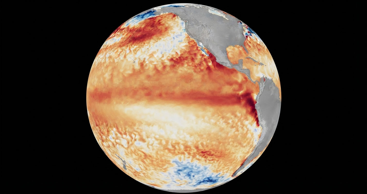
WASHINGTON, July 7 (San Diego News Online) — NOAA forecasters say El Niño is now present in the equatorial Pacific and is expected to strengthen into the Northern Hemisphere winter of 2026-27. The practical takeaway for coastal residents, planners and anyone watching seasonal weather trends: follow NOAA’s outlooks and local flood guidance as fall approaches, especially if you live in an area that sees high-tide flooding.
On June 11, the National Oceanic and Atmospheric Administration’s Climate Prediction Center issued an El Niño Advisory. The agency said El Niño conditions are present and expected to strengthen into the Northern Hemisphere winter 2026-27, and it put the chance of a very strong El Niño during November-January at 63%.
What El Niño is
El Niño is the warm phase of ENSO, the El Niño-Southern Oscillation. NOAA’s Climate.gov describes ENSO as a climate pattern in the tropical Pacific that can influence weather far beyond that region. During El Niño, sea surface temperatures in the central and eastern equatorial Pacific run warmer than average.
NOAA’s Climate Prediction Center said those warmer waters have developed over the past month. It reported above-average sea surface temperatures across the central to eastern equatorial Pacific, with the latest weekly Niño-3.4 index at +0.7°C. NOAA also said the Niño-4 index was +0.7°C and the Niño-1+2 index was +2.1°C.
Why the forecast matters
El Niño does not mean the same weather for every place, and it is not a storm. It is a signal that can tilt the odds for seasonal patterns. NOAA’s Ocean Service says El Niño can affect conditions in many U.S. locations, including the risk of high-tide flooding.
That is why the forecast is most useful as a planning tool. People along the coast, and agencies responsible for drainage, transit and emergency planning, often watch these outlooks months ahead of the winter season.
What NOAA expects next
The Climate Prediction Center said its model guidance, including the North American Multi-Model Ensemble and the NCEP CFSv2, points to El Niño strengthening into winter. The same NOAA advisory said there is a 63% chance of a very strong event in November-January.
Some NOAA educational pages still describe the tropical Pacific in general terms as ENSO-neutral because they are broad explainers, but the June 11 Climate Prediction Center advisory is the current forecast update saying El Niño conditions are already present.
For now, the key point is simple: NOAA says the Pacific has shifted into El Niño, and forecasters expect it to grow stronger through the winter ahead.
